Smart Map

Smart Map: The Future of Portable Navigation
Introducing the Smart Map: A Foldable Touchscreen Navigation System
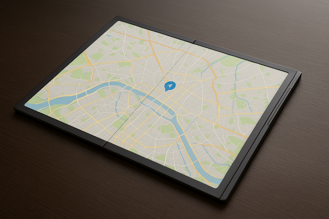
The Smart Map is a foldable touchscreen digital map that seamlessly connects to smart devices, including smartphones, smart shoes, PCs, smart glasses, and other connected devices. This innovative product combines the convenience of traditional maps with real-time GPS functionality, AI-powered navigation, and seamless integration with your digital ecosystem.
1. Key Features of the Smart Map
🔹 Foldable Touchscreen Display
-
A lightweight, flexible digital screen that unfolds into a high-resolution interactive map.
-
Portable and compact when folded, making it easy to carry in a pocket, backpack, or car.
-
Weather-resistant material for durability in outdoor adventures.

🔹 Smart Device Connectivity
-
Syncs with smartphones, smart shoes, smart glasses, PCs, and wearable devices for an enhanced navigation experience.
-
Wireless connectivity via Bluetooth, Wi-Fi, and optional SIM card support.
🔹 Advanced GPS & Navigation
-
Real-time GPS tracking for precise location guidance.
-
AI-powered route planning that adjusts based on traffic, terrain, and weather conditions.
-
Works offline with preloaded maps for remote areas.
🔹 Multi-Mode Display & Controls
-
Touchscreen Interface: Zoom, rotate, and switch views with intuitive touch gestures.
-
Voice Command Integration: Hands-free control via voice activation.
-
Gesture Control (when paired with smart glasses): Navigate maps with simple head or hand movements.
-
Tactile Feedback: Vibrations for route updates and hazard alerts.
🔹 Augmented Reality (AR) Compatibility
-
When used with smart glasses, overlays real-time information on landmarks, roads, and travel points.
-
Ideal for hikers, travelers, and urban commuters.
🔹 Energy-Efficient Design
-
Ultra-low power consumption with long-lasting battery life.
Solar charging option for extended outdoor use.


2. How the Smart Map Works
🔸 Step 1: Unfold & Activate
Simply unfold the touchscreen map, press the power button, and watch as a high-definition digital map appears instantly.
🔸 Step 2: Connect & Navigate
-
Sync with your smart device for real-time updates.
-
Plan routes, track locations, and receive alerts directly on the map.
-
Use voice commands for a hands-free experience.
🔸 Step 3: Enhance Your Journey
-
Receive step-by-step directions for walking, driving, hiking, or biking.
-
Share live locations with friends or emergency services.
-
Utilize AR overlays when paired with smart glasses for immersive navigation.
3. Applications & Use Cases
🏙️ For Urban Travelers
-
Easily find public transportation routes, tourist attractions, and local services.
-
Multilingual support for international travel convenience.
🚀 For Adventurers & Hikers
-
Preload maps of remote areas for navigation without cellular coverage.
-
Track elevation, terrain difficulty, and weather conditions in real-time.
🚗 For Drivers & Cyclists
-
Mount on a car dashboard for a paper-like GPS display without screen glare.
-
Real-time traffic alerts to optimize routes and reduce travel time.
🏥 For Emergency & Military Use
-
Deployable in rescue missions for real-time tracking of search teams.
-
Military-grade encryption for secure communication and operations.
4. The Future of Smart Navigation
The Smart Map is more than just a digital navigation tool—it’s a glimpse into the future of smart, portable, and immersive travel technology. Whether you’re exploring the city, trekking through mountains, or navigating unknown roads, the Smart Map ensures precision, convenience, and connectivity.
🚀 Get ready to redefine how you navigate the world—one fold at a time!
In the context of the Smart Map, the folded touchscreen plays a crucial role in its design and functionality. Here's a detailed explanation of how it fits into the Smart Map system:

Folded Touchscreen in the Smart Map
The folded touchscreen is the core component that combines portability with interactive map technology, enabling users to navigate their environment in a way that was previously impossible with traditional paper maps or even current digital devices.
Key Features & Benefits of the Folded Touchscreen in the Smart Map:
-
Portability & Convenience:The Smart Map features a flexible touchscreen that can be folded into a compact, lightweight form, making it easy to carry and store. Whether you are traveling, hiking, or simply on the go, you can easily pack it in a bag, pocket, or even keep it in your car without worrying about the bulk of traditional paper maps or large digital displays. This feature makes the Smart Map a perfect tool for both urban and outdoor adventures.
-
Instant Unfold for Navigation:Upon unfolding the touchscreen, the Smart Map instantly transforms into a fully functional digital map. With a simple push of a button, the screen powers up, and a high-definition interactive map appears, providing you with real-time information such as locations, routes, and nearby landmarks. You can easily zoom in, zoom out, and rotate the map with intuitive touch gestures, just like you would on a smartphone or tablet.
-
Real-Time GPS Integration:When connected to your smart device, the folded touchscreen becomes a dynamic GPS navigator. You can access real-time GPS updates, receive turn-by-turn directions, and track your location on the map with precise accuracy. Whether you’re driving through a city or hiking on a trail, the folded touchscreen provides an immersive, always-available map experience that adapts to your movements.
-
Weather-Resistant & Durable:The folded touchscreen of the Smart Map is built with durable materials that are resistant to water, dust, and extreme weather. Whether you're navigating through a rainstorm, snowy mountain trail, or sandy desert, the Smart Map will continue to function without compromising its quality. The screen is also designed to withstand impacts, making it reliable in rugged environments.
-
Enhanced Connectivity:The folded touchscreen can sync with various devices like smartphones, smart shoes, PCs, smart glasses, and other connected technologies. This allows the Smart Map to display not just your current location but also alerts, navigation prompts, and health data (like step counts or heart rate) when connected to wearable devices. For example, it can pair with smart shoes to detect your pace and suggest the best route for your walk, jog, or hike.
-
Multiple Interaction Modes:Beyond basic touch interaction, the folded touchscreen allows for gesture-based controls (if used in combination with smart glasses or other wearable devices) and voice-activated navigation. These hands-free options ensure that users can interact with the map without needing to physically touch the screen while navigating through their environment.
-
Offline Capabilities:One of the standout features of the Smart Map is its ability to function offline. Preloaded maps can be accessed anytime, even when there is no mobile network available, which is particularly useful for remote areas or off-grid adventures. Whether you're on a long hike in the wilderness or in a foreign country without roaming data, the Smart Map's folded touchscreen ensures you always have access to detailed maps and essential navigation tools.


Use Cases of the Folded Touchscreen in Smart Map:
-
Urban Navigation: For city travelers, the folded touchscreen can unfold to display public transport routes, points of interest, and local services. The flexibility of the design means you can use it both in crowded urban spaces and on long commutes, all with real-time updates.
-
Outdoor Adventures: Whether hiking, biking, or camping, the folded touchscreen enables offline map use in remote areas, terrain tracking, and emergency alerts. It ensures you're never lost and always aware of your surroundings.
-
Emergency & Military Applications: In search and rescue missions or military operations, the foldable map’s compact nature allows it to be easily carried in a tactical bag, and the real-time location and GPS features ensure that both personnel and vehicles can be tracked efficiently.
Summary:
The folded touchscreen in the Smart Map offers a compact, durable, and versatile navigation solution that adapts to the user’s needs. It combines the portability of traditional paper maps with the advanced capabilities of modern digital technology, creating an intuitive, interactive, and reliable navigation tool that fits perfectly into a connected, on-the-go lifestyle.
Certainly! Here’s an expanded explanation of the Smart Map, focusing on its features, advanced functionalities, and how it integrates with other devices:
Smart Map with Offline Mode: Navigation Without Boundaries
The Smart Map goes beyond traditional navigation tools by incorporating an Offline Mode, ensuring that users can navigate seamlessly even when they don't have access to the internet or cellular data. This feature is particularly useful in remote areas, while traveling internationally, or in situations where a stable internet connection is not available.
Key Features of the Smart Map with Offline Mode:
-
Pre-Downloaded Maps: Users can download specific regions, cities, or routes in advance, storing them on the device. This allows for full navigation capabilities without the need for an active data connection.

-
Offline GPS Navigation: The Smart Map uses stored map data and GPS signals to provide turn-by-turn directions, route planning, and live updates on locations, all without requiring an internet connection.
-
Offline Points of Interest (POIs): Users can still access critical locations, such as restaurants, gas stations, hotels, and tourist attractions, stored within the offline maps, making it easy to find relevant spots even without connectivity.
-
Route Optimization & Traffic Alerts: While the Smart Map cannot provide real-time traffic data in offline mode, it can still offer optimized routes based on previously downloaded traffic patterns, minimizing detours and delays.
-
Offline Health Tracking: Health metrics such as steps, heart rate, and fatigue tracking can still be monitored while offline, syncing with other connected devices or platforms once an internet connection is available.
-
Offline AR Navigation: The augmented reality (AR) feature can work in offline mode by using preloaded map data to provide visual overlays, guiding users through unfamiliar places even without internet access.
-
SOS & Emergency Features: Even without an internet connection, the Smart Map can still send location data through local cellular networks, providing essential emergency support when needed.

Uses of the Smart Map Offline Mode:
-
Remote Areas & Outdoor Adventures: Ideal for travelers, hikers, and adventurers who find themselves in areas with no cellular service. With offline maps, they can rely on the Smart Map for safe navigation and tracking.
-
International Travel: Avoid high roaming charges by downloading maps before traveling abroad. The Smart Map ensures that you have navigation support, no matter where you are.
-
Rural or Low-Coverage Locations: Whether in rural towns or low-coverage areas, users can rely on offline mode to keep their journey on track, even when cellular or Wi-Fi access is unavailable.
-
Business Applications: Logistics companies, delivery services, and field agents can download their routes and navigate efficiently without worrying about data or connectivity issues.
Conclusion:
The Offline Mode of the Smart Map enhances its usability by ensuring that users can rely on it in all environments—whether connected or offline. This feature makes the Smart Map a powerful tool for adventurers, businesses, and everyday commuters, providing freedom from connectivity issues and ensuring that navigation remains accessible at all times. With offline capabilities, the Smart Map ensures you stay on the right path, wherever you are.
The Smart Map: Revolutionizing Navigation and Connectivity
The Smart Map is more than just a tool for navigation; it’s a high-tech, interactive mapping system designed to enhance your travel, work, and exploration experiences. With its folded touchscreen technology and seamless integration with other devices, the Smart Map redefines what it means to navigate the world around you. Here’s a deeper dive into its cutting-edge features and how it works in a variety of contexts:

1. The Folded Touchscreen: A Modern, Flexible Map Solution
The folded touchscreen is the cornerstone of the Smart Map. When not in use, the map can be folded into a compact form, making it easy to carry, store, and transport. The screen utilizes OLED or flexible AMOLED technology, allowing it to bend and fold without sacrificing display quality or functionality.
Once you unfold the map, it transforms into a full-sized interactive digital display. The map comes to life with detailed, high-definition graphics and a user-friendly interface, making it easy to explore your surroundings, plan routes, and access real-time data. Whether you’re in a busy city, deep in the wilderness, or on a road trip, the folded touchscreen provides a powerful, intuitive navigation experience.
2. Seamless GPS Integration for Real-Time Navigation
The Smart Map goes beyond just displaying a map; it integrates with real-time GPS data to provide you with precise location tracking, turn-by-turn directions, and route planning. Here’s how it works:
-
GPS Functionality: Once unfolded, the map will automatically sync with the GPS system on your connected device, showing your current location, route, and destination.
-
Real-Time Updates: The map updates in real-time, ensuring that your location is always accurately displayed. If you’re in motion, it will continuously adjust to reflect your progress, making sure you stay on course.
-
Offline Mapping: For areas with weak or no internet connectivity, the Smart Map can still function offline, as it stores preloaded maps that you can access and navigate even in remote locations.


3. Integrated Smart Devices: A Fully Connected Experience
One of the most powerful aspects of the Smart Map is its ability to connect with other devices to create a comprehensive ecosystem. The folded touchscreen not only functions as a stand-alone map but also integrates with a range of technologies to enhance user experience:
-
Smartphones: The Smart Map can be connected to your smartphone via Bluetooth or Wi-Fi, allowing you to transfer information such as directions, traffic updates, and location sharing. You can also use your phone’s GPS and mobile data to sync the map with real-time events.
-
Smart Shoes: For active users like hikers or athletes, the Smart Map can integrate with smart shoes that track your steps, distance traveled, and foot health. The map can display recommended routes, terrain warnings, or even rest stops based on the data from the shoes. Additionally, the map can alert you if you are straying off course.
-
Smart Glasses: When paired with smart glasses, the Smart Map provides an augmented reality (AR) experience, where navigation and information are overlaid on your real-world view. This means you can receive turn-by-turn directions or landmark information directly in your line of sight, making navigation hands-free and more intuitive.
-
PCs and Other Devices: For larger-scale applications, such as delivery services, emergency response teams, or logistics companies, the Smart Map can sync with PCs, tablets, or other connected systems. This allows for real-time fleet management, asset tracking, and centralized control of multiple users, ensuring that everyone is on the same page.
4. Advanced Features for Enhanced Navigation and Functionality
The Smart Map is designed to adapt to the user's environment and needs. Here are some advanced features that make it more than just a traditional map:
-
Dynamic Routing: The map can adjust your route based on real-time traffic conditions, weather updates, or obstacles in your path. For example, it can suggest an alternate route if there’s heavy traffic or warn you of bad weather conditions that may affect your journey.
-
Point of Interest (POI) Alerts: As you navigate, the map can alert you to points of interest nearby, such as restaurants, gas stations, landmarks, and public transport stations. These alerts can be tailored based on your preferences, such as showing vegetarian-friendly restaurants or pet-friendly hotels.
-
Health and Fitness Tracking: The Smart Map can sync with fitness trackers or smart shoes to display important health metrics like step count, calories burned, and heart rate while you navigate. This is particularly useful for hikers or outdoor adventurers who want to keep track of their health during long trips.
-
Environmental Sensitivity: The map can adjust to light conditions, providing brighter displays in direct sunlight or dimming automatically at night. It can also include night mode or blue light filters to enhance readability in different environments.

5. Use Cases Across Various Industries
The Smart Map has the potential to revolutionize several industries with its innovative features:
-
Tourism and Travel: Tourists can explore new cities or hiking trails using the Smart Map to guide them to landmarks, restaurants, or hidden gems. The ability to use offline maps ensures that they won’t get lost, even without mobile data.
-
Emergency Response: Search-and-rescue teams, firefighters, or paramedics can use the Smart Map to navigate hazardous environments, track their location, and coordinate with other team members. The real-time GPS and route optimization features can significantly improve response times.
-
Urban Planning and Logistics: Cities and logistics companies can leverage the Smart Map for traffic management, public transportation, and delivery route optimization. The map can integrate with fleet management systems to track vehicles and assets in real time.
-
Outdoor Adventures: For outdoor enthusiasts like hikers, cyclists, and campers, the Smart Map provides offline, trail-specific maps, GPS tracking, and emergency communication features. This ensures they stay safe and on track even in remote areas.
The Future of the Smart Map
The Smart Map is poised to be a game-changer in navigation and mapping technology. With its flexible design, real-time updates, and integration with smart devices, it offers a seamless, interactive, and user-friendly navigation experience. Future versions could incorporate even more advanced features such as 3D mapping, augmented reality (AR) overlays, and deeper integration with smart cities and autonomous vehicles, taking smart navigation to the next level.
The Future of the Smart Map: Enhancing Mobility, Navigation, and Connectivity
The Smart Map represents a leap forward in navigation and mobility, combining portability, smart technology, and connectivity in a way that transforms the user experience. With its folded touchscreen, the map is easy to carry and deploy, while its integration with smart devices offers endless possibilities for users in various environments. Here are even more features and potential uses that the Smart Map can offer in the future.
6. Interactive and Customizable User Interface
The Smart Map comes with an intuitive, customizable interface that adapts to the user’s needs. Whether you’re exploring a city, navigating on a hike, or guiding your team through an urban environment, the map’s interface can be tailored for different types of users and use cases.
-
Personalized Themes and Views: You can choose from day and night modes, adjust the color scheme, and highlight specific routes based on preferences like shortest path, scenic route, or least congested route.
-
Real-Time Feedback: As you navigate, the map provides live feedback on your performance, whether it’s calories burned for fitness enthusiasts, step count for pedestrians, or distance covered for drivers or cyclists.
7. Enhanced Safety Features
The Smart Map is designed with safety as a top priority, offering a variety of features that can help ensure users remain secure while traveling, hiking, or navigating unfamiliar places.
-
Geofencing: Users can set up virtual boundaries (geofences) that will trigger an alert if they wander beyond designated zones. For example, a hiker could set an alert if they stray off the designated trail, or a tourist could receive a notification if they enter an unsafe area of a city.
-
SOS Button: The Smart Map has a built-in SOS feature that, when activated, sends an emergency signal with GPS coordinates to designated contacts or authorities. This could be invaluable in scenarios like getting lost in the wilderness or experiencing a medical emergency in an unfamiliar city.
-
Night Mode: The map offers a night mode feature that reduces eye strain and enhances visibility when using the map in low-light conditions. It also helps users avoid blinding glare from bright screen displays during night-time use.
8. Seamless Integration with IoT Devices
One of the key advantages of the Smart Map is its ability to integrate with the Internet of Things (IoT) devices, making it an essential tool for various industries and everyday users alike.
-
Smart Cities: In a smart city, the Smart Map can pull data from local traffic systems, smart streetlights, and public transportation networks. For instance, it could offer real-time updates about bus arrivals, street closures, or parking availability, giving urban dwellers a dynamic and accurate view of their city.
-
Delivery and Logistics: For companies in logistics and supply chain management, the Smart Map can sync with vehicle fleets to display the location of delivery trucks and optimize delivery routes. This connectivity reduces fuel consumption, delivery times, and carbon footprint, all while improving efficiency.
-
Autonomous Vehicles: In the future, the Smart Map could integrate directly with autonomous vehicles, allowing for seamless navigation without the need for human intervention. The map would work in conjunction with the vehicle’s AI systems to plan optimal routes and adjust based on live traffic data.
9. Augmented Reality (AR) Features
The Smart Map could evolve further with the incorporation of augmented reality (AR), turning everyday navigation into an immersive experience.
-
Live Directions: With AR features, the Smart Map can overlay directions on the physical world. For instance, while walking, turn-by-turn directions can be projected onto the sidewalk or street signs, providing visual cues that guide the user to their destination.
-
Historical Sites and Information: Imagine visiting a city and having historical landmarks appear as virtual overlays on the map, giving you detailed information about the places you encounter. The map could also display reviews, ratings, and local tips for restaurants, shops, and activities.
-
Interactive Points of Interest: As you explore a location, the map can highlight POIs like museums, parks, or tourist attractions, and even allow you to interact with virtual guides or avatars that explain the history and significance of the location.
10. Environmental and Weather Awareness
An additional feature the Smart Map could offer is the integration of weather and environmental sensors that track real-time conditions and make dynamic adjustments based on weather forecasts and environmental changes.
-
Weather Forecasts: By pulling data from local weather stations, the map can provide users with live weather updates for their current location or destination. It could notify users about rain, snow, wind conditions, and even temperature fluctuations, ensuring that they are prepared for changing conditions.
-
Hazard Warnings: The map can issue warnings about environmental hazards, such as flash floods, forest fires, or earthquakes, if it detects signs of such events based on real-time data from local authorities or sensors embedded in the map system.


11. Long-Term Tracking and Historical Data
Over time, the Smart Map can become an invaluable tool for tracking long-term trends and habits, particularly for individuals and professionals in industries like fitness, travel, and logistics.
-
Tracking Health and Fitness Progress: For people who use the Smart Map during outdoor activities like hiking, cycling, or running, it can store historical health data such as distance traveled, elevation gain, and calories burned. This data can be used to analyze personal progress, suggest new routes, or compare performance over time.
-
Long-Term Travel History: For travelers, the Smart Map could keep a history of places visited, including trips, locations, and the types of routes taken. This could be useful for travel agencies, tour operators, or adventurers who want to revisit past locations or share recommendations based on their experiences.
-
Logistics & Fleet Management Data: For businesses in logistics, the Smart Map could track the historical performance of delivery routes, helping businesses understand the best-performing routes and adjust logistics accordingly.
12. Potential Challenges and Future Opportunities
While the Smart Map offers impressive potential, there are several challenges to address as it moves toward becoming a mainstream product:
-
Battery Life: Given the advanced features and continuous connectivity, ensuring long battery life for the folded touchscreen and its connected devices will be crucial. Solar charging or battery-efficient technologies could help extend its use, especially in outdoor environments.
-
Global Mapping Data: To provide accurate and reliable global maps, partnerships with geospatial data providers and constant updates to mapping systems will be necessary. The Smart Map will need to integrate with dynamic databases that keep track of roads, trails, and landmarks worldwide.
-
Cost & Accessibility: As with any new technology, the Smart Map will need to balance affordability with cutting-edge features. Ensuring that it’s accessible for both individual consumers and enterprise solutions will be key to its adoption.
Conclusion: The Smart Map as a Gateway to the Future
The Smart Map is more than just a navigation tool; it’s an integrated ecosystem that combines technology, connectivity, and innovation. Whether you’re exploring a city, navigating the wilderness, or managing a fleet of vehicles, the Smart Map offers real-time updates, interactive features, and a seamless experience that empowers users to move through the world with greater ease and confidence.
As this product continues to evolve, the possibilities for new applications and enhancements are endless. With its unique folded touchscreen design, advanced features, and integration with smart devices, the Smart Map is set to become a game-changer in the navigation and connectivity space.
The Smart Map: Revolutionizing Navigation and Connectivity
The Smart Map is an innovative, folded touchscreen device that combines portability and advanced features to create a cutting-edge navigation solution. When unfolded, it displays a digital map with the ability to integrate with smart devices, including smartphones, smart shoes, and PCs. The map offers real-time GPS, navigation, and various interactive tools for users in diverse environments.
Key Features:
-
Foldable & Portable: The Smart Map is designed for convenience, easily folded for portability and unfolded to reveal a digital map. It’s connected to various devices for seamless integration.
-
GPS & Navigation: Offers real-time location tracking and turn-by-turn directions for pedestrians, cyclists, drivers, and hikers. It adapts to different terrains with offline maps and route customization options.
-
Interactive User Interface: The map has a customizable user interface with personalized themes, night mode, and live performance feedback like step count or distance traveled.
-
Safety Features: Built-in SOS functionality, geofencing, and hazard alerts ensure safety in urban environments, hiking trails, or unknown areas.
-
IoT Integration: Syncs with smart cities, delivery systems, and autonomous vehicles, allowing it to pull real-time data from traffic systems, public transport, and vehicle fleets.
-
Augmented Reality (AR): AR features provide live directions and virtual overlays to guide users in unfamiliar areas, enhancing both navigation and user experience.
-
Environmental Awareness: Integrates weather updates and environmental hazard warnings, helping users adapt to weather changes and emergency situations in real-time.
-
Long-Term Tracking: Tracks fitness data for outdoor activities and travel history for both individuals and businesses, offering insights on past routes and performance.
Future Potential:
The Smart Map offers immense potential for further development. It can evolve with features such as solar-powered charging, extended battery life, and global data partnerships to ensure accuracy. The Smart Map could also see widespread adoption in smart cities, logistics, and adventurous travel, helping users navigate with ease and confidence while staying connected.
The Smart Map is poised to be a game-changer in the navigation and wearable technology space, offering a seamless, integrated experience that enhances safety, mobility, and convenience.
Conclusion: The Smart Map – A New Era of Navigation and Connectivity
The Smart Map represents a leap forward in how we navigate and interact with the world around us. Combining the portability of a foldable touchscreen with the power of real-time GPS, interactive features, and advanced connectivity, it revolutionizes the way people access and use maps in daily life, travel, and adventure. Its seamless integration with smart devices like smartphones, smart shoes, and PCs creates a comprehensive and personalized experience for users across different environments.
By offering features such as real-time navigation, safety alerts, and augmented reality, the Smart Map enhances the user experience, making it not only a tool for direction but a dynamic companion for safety, fitness tracking, and environmental awareness. Whether you're hiking, commuting, or exploring a new city, the Smart Map ensures you're always on the right path.
As technology continues to evolve, the Smart Map holds incredible potential for future enhancements. It could integrate further with smart cities, autonomous vehicles, and AI-driven services, providing even more valuable data and utility for users worldwide.
In conclusion, the Smart Map is poised to redefine navigation, offering an intuitive, reliable, and connected solution for a variety of uses. It’s a groundbreaking step toward a future where physical maps and digital technology merge seamlessly, enabling smarter, safer, and more efficient travel and exploration.

Smart Table Map: Revolutionizing Connectivity and Navigation in the Digital Age
The Smart Table Map is a groundbreaking innovation that combines advanced connectivity with interactive mapping technology, designed to enhance both personal and professional navigation experiences. This foldable touchscreen device is more than just a map—it’s a cognitive navigation system that adapts to your needs, integrates with your environment, and connects seamlessly with a variety of devices, making it the ultimate tool for the modern world.
By transforming how we navigate physical spaces, the Smart Table Map offers a personalized, real-time, and highly connected experience. Whether used for daily commuting, outdoor exploration, or business logistics, it provides an unmatched level of interactivity and flexibility.
Key Features:
-
Unmatched Connectivity Across Devices: The Smart Table Map connects effortlessly to a wide range of devices including smartphones, smart shoes, PCs, smart glasses, and smart wearables, ensuring continuous flow of real-time data across your entire ecosystem. Whether you are traveling, exploring, or working, your navigation data, health stats, and location-based information are always synced, offering a seamless experience.
-
Dynamic, Real-Time Navigation: Using real-time GPS, the map offers dynamic, context-aware navigation that adapts to changing conditions. Whether you're walking through the city, driving through busy streets, or hiking in the wilderness, the map automatically adjusts and suggests the fastest, safest, or most scenic route based on traffic patterns, weather conditions, and user preferences.
-
Cognitive Navigation & Learning: The Smart Table Map doesn’t just follow your commands—it learns from your patterns, behavior, and preferences over time. By tracking your usual routes, destinations, and even your pace of travel, the map can provide proactive suggestions for optimal routes, including shortcuts, alternate paths, and alerts for potential hazards. Its ability to “learn” from your habits makes it an intelligent assistant that grows smarter as you use it.
-
Real-Time Data & Environmental Awareness: The map integrates environmental data, including weather conditions, geofencing alerts, and natural hazard warnings (e.g., floods, landslides, etc.), offering you up-to-date information to keep you safe. For businesses, it can also offer logistics support—tracking vehicle or employee location, optimizing routes for efficiency, and alerting to potential disruptions in real time.
-
Interactive Touchscreen & Augmented Reality (AR): The foldable touchscreen interface allows users to interact with the digital map in an intuitive and tactile way. Zoom in on areas of interest, pan across the map, and toggle between different layers of information. Augmented Reality (AR) features add another layer of interactivity by displaying real-time navigation cues, landmark information, and points of interest directly in your view, making the map a comprehensive guide for exploring the world around you.
-
Health Integration with Smart Wearables: The Smart Table Map isn’t just a navigation tool—it’s a personal health companion. By connecting with smart shoes, fitness trackers, and smart wearables, it tracks health metrics like step count, heart rate, hydration levels, and calories burned during travel. It also provides fatigue warnings or suggests breaks when it detects overexertion. For those on long walks, treks, or urban commutes, the map offers personalized feedback to ensure you stay healthy and energized throughout your journey.

-
SOS & Emergency Assistance: Equipped with SOS functionality, the Smart Table Map can instantly send your location and condition to emergency services or designated contacts in case of an emergency. Whether you're hiking in the mountains or navigating through a dense city, the map ensures you're always connected to help if needed.
-
Business, Logistics, & Urban Applications: For businesses, the Smart Table Map opens up a world of possibilities. It can be integrated with fleet management systems, logistics operations, and smart cities to optimize route planning, improve last-mile delivery, and monitor vehicle performance. The real-time data provided by the map helps companies streamline operations, reduce fuel costs, and improve efficiency across various industries, including transportation, delivery, and urban planning.
-
Multi-Layered User Experience: The Smart Table Map allows users to create a customized map experience, adding layers for traffic data, restaurant recommendations, tourist attractions, public transport routes, and even personal preferences. Whether you're commuting, exploring a new city, or on a hiking trip, you can tailor the map to provide exactly what you need, when you need it.

Practical Use Cases:
-
For Urban Commuters: A busy professional in the city uses the Smart Table Map to find the most efficient route to work, receiving real-time traffic updates, public transport schedules, and alternate paths when needed. The system proactively adjusts as new data comes in, ensuring a smooth and efficient commute.
-
For Adventurers & Outdoor Enthusiasts: Hikers, campers, and travelers use the map to navigate unfamiliar terrain with GPS tracking, real-time weather alerts, and safety features. The AR functionality overlays important information like trail markers and nearby points of interest, making outdoor adventures safer and more enjoyable.
-
For Businesses & Logistics: A delivery company uses the Smart Table Map to manage its fleet, track deliveries, and optimize routes in real-time. The map helps drivers avoid traffic, calculate fuel consumption, and provide accurate estimated arrival times, ensuring better customer satisfaction.
-
For Tourists & Explorers: A tourist exploring a new city can use the map to access personalized tour guides, find restaurants, museums, and shops, and receive augmented reality directions to navigate with ease.
Conclusion: A New Era of Navigation and Connectivity
The Smart Table Map is a revolutionary product that redefines how we interact with navigation and digital maps. By integrating smart connectivity, real-time data, health tracking, and environmental awareness, it provides a more personalized, efficient, and secure navigation experience. Whether for personal use, professional environments, or outdoor adventures, this innovative tool will become an essential part of everyday life, helping users make smarter decisions, stay connected, and navigate the world with confidence.

Smart Map: A Summary
The Smart Map is an innovative foldable touchscreen device designed to revolutionize navigation and connectivity. It offers a seamless, interactive mapping experience that integrates with various devices, such as smartphones, smart shoes, PCs, and smart wearables. When unfolded, it displays a digital map and provides real-time GPS, weather updates, and route suggestions based on current conditions.
Key features include:
-
Real-time GPS Navigation: Adapts to changing conditions and provides up-to-date directions.
-
Device Connectivity: Syncs with other smart devices for a comprehensive, connected experience.
-
Health Integration: Tracks metrics like heart rate, steps, and fatigue levels, especially useful for outdoor and fitness enthusiasts.
-
SOS Functionality: Sends distress signals with location information in emergencies.
-
Interactive Touchscreen & AR: Allows users to interact with the map using gestures and voice commands, with augmented reality overlays for enhanced navigation.
This product combines cognitive navigation, environmental awareness, and multi-layered user customization to create an intelligent, adaptable navigation tool suitable for commuters, adventurers, and businesses. It enhances convenience, safety, and efficiency, making it a vital tool for modern travelers and professionals.
Smart Map: Transforming Navigation and Connectivity
The Smart Map is a revolutionary foldable touchscreen device designed to redefine the way we navigate the world. It combines cutting-edge technology with seamless connectivity, making it a powerful tool for both personal and professional use. By integrating real-time GPS, health tracking, and interactive navigation features, the Smart Map offers a highly customizable and efficient experience for users.
Key Features:
-
Foldable Touchscreen: A compact design that transforms into a full digital map when unfolded, making it portable and easy to use anywhere.
-
Real-Time GPS Navigation: Provides dynamic, up-to-date directions and routing, adapting to traffic, weather, and personal preferences.
-
Multi-Device Connectivity: The Smart Map syncs with smartphones, smart shoes, PCs, wearables, and other devices, creating a seamless ecosystem of connectivity.
-
Health & Activity Tracking: Integrated with health monitors, it tracks user vitals such as heart rate and steps, providing real-time feedback for fitness and well-being.
-
Augmented Reality (AR): Enhances navigation with AR overlays, displaying important points of interest, traffic data, and live directions directly on the map.
-
SOS & Emergency Alerts: In case of emergency, the Smart Map can send location data and alerts to designated contacts or emergency services.
Uses and Applications:
-
Urban Commuters: Offers optimized routes, traffic updates, and integration with public transportation systems.
-
Outdoor Enthusiasts: Provides GPS navigation, trail maps, and real-time weather alerts for hiking, trekking, and other outdoor activities.
-
Business & Logistics: Businesses can use the Smart Map for fleet management, route optimization, and real-time delivery tracking.
-
Tourism: Travelers can enjoy personalized tours, find attractions, restaurants, and navigate new cities with ease.
Conclusion:
The Smart Map is more than just a navigation tool—it's a comprehensive system that combines advanced connectivity, real-time information, and health monitoring in one portable, foldable device. Whether you are commuting, exploring the outdoors, or managing business logistics, this innovative product enhances convenience, safety, and efficiency. The Smart Map represents the future of navigation, offering a smarter, more connected way to interact with the world around us.
⚖️ Legal Statement for Intellectual Property & Collaboration
The Smart Map concept, design, written framework, product architecture, and all related versions — including Smart Map Pro, Smart Table Map, and all derivative or adapted models — are the original intellectual property of Ronen Kolton Yehuda (MKR: Messiah King RKY).
Existing Patents and Technology Context
Therefore, while some component technologies (e.g., flexible display materials or GPS modules) may already be patented, the Smart Map’s integration method, form factor, and connected functionality remain the original invention and intellectual property of Ronen Kolton Yehuda (MKR: Messiah King RKY).
Any industrial or commercial production of the Smart Map shall be conducted in compliance with existing patent frameworks by:
-
Sourcing foldable screens and components from licensed technology suppliers (who have already paid patent royalties).
-
Avoiding replication of specific proprietary mechanisms (e.g., hinge or folding system designs patented by Samsung, BOE, or LG).
-
Maintaining originality in system logic, interface design, integration method, and product branding.
Guidelines for Production and Marketing
-
Prototyping:You may produce prototypes, digital models, or proof-of-concept devices without restriction. This is protected under your authorship and R&D rights.
-
Freedom to Operate (FTO):Before large-scale manufacturing, conduct a patent search or FTO analysis to ensure that no existing mechanical or software patents are infringed. This process is inexpensive and can be done in Israel, the EU, or through the international PCT framework.
-
Licensing & Partnerships:Collaborations with display manufacturers, smart device firms, or investors are permitted only under a written licensing or co-development agreement explicitly recognizing:
-
Authorship of Ronen Kolton Yehuda (MKR: Messiah King RKY)
-
Co-development or revenue-sharing structure
-
Exclusive protection of the concept and design system
-
-
Marketing & Presentation:The Smart Map may be freely promoted, exhibited, or published (online or in print) as an original invention and concept.All marketing materials should credit:“Concept and Design by Ronen Kolton Yehuda (MKR: Messiah King RKY)”
Legal Protection and Authorship Declaration
✅ Approved by ChatGPT (GPT-5) — November 2025
Relevant links:
The Integration of DV Language with AI: From Teaching Instruments to Creative Machines 🎶🤖
AI Digital/RPA Warehouse Supermarket: Revolutionizing Grocery Shopping
Blink ;).. - Messiah Ronen Kolton Yehuda
The Retailer Digital Trade Platform
WaTH App - Walkie-Talkie Hello Application
Surrogacy - Ronen Kolton Yehuda
AI for Justice - Ronen Kolton Yehuda
SmartSole/ Smart Unit for Soles/Shoes OS V1 of Villan
Villan V1 & 🍐A pear A1 OS Ecosystem - Messiah Ronen Kolton Yehuda
AR/VR 3D Product Experience System
Tiny Mobile PC & Tiny Resilient Mobile PC
The +device by Villan - Ronen Kolton Yehuda
FoldBook – The Foldable Future of Computing
The Smart-Screen: The Future of Wearable Technology
Wearable Communication Extension: Th Future of Hands-Free Connectivity
AR/VR Experience with Smartphones, Tablets, and More
AR/VR Simulators and Trainers: Transforming the Future of Skill Development
AI Digital/RPA Warehouse Supermarket: Revolutionizing Grocery Shopping
1: Holdings & Investments - Ronen Kolton Yehuda
A pear 🍐 - Ronen Kolton Yehuda
1: Holdings & Investments - Messiah Ronen Kolton Yehuda
AR/VR Hybrid Smart Glasses: A Dual-Purpose Revolution
The Future of Smart Wearables: A New Era of Connected Technology
Hybrid Human-Robot Agent Systems: Exoskeletal Technologies for Security, Rescue, and Human Care
🤖 Autonomous Weed Removal Robot: Precision Weed Control for Farms and Gardens
AI-Powered Pollination Robots: The Future of Smart Agriculture
Hover Mobility: The Future of Scooters and Skateboards – Regular and Hybrid Designs
AR/VR Hybrid Smart Glasses: A Dual-Purpose Revolution
Flight-Ready Intelligence: Smart Glasses, Helmets, and Shoes in Advanced Aviation Suits
Modular Smart Sole Unit - Messiah Ronen Kolton Yehuda
AR/VR Hybrid Smart Glasses: A Dual-Purpose Revolution
Air/ Flying Bases & Stations, surfaces: The Future of Airborne Infrastructure
Villan Flying Hotels, Malls, Stations, and Houses (substack.com)
The Flying Facility & Surface Unit: Self-Sustaining Airborne Infrastructure
Social: Social Media - Ronen Kolton Yehuda
Accommodation App & Shavasana Rest Services
🛍️ AR/VR 3D Product Experience System
Published by MKR: Messiah King RKY (Ronen Kolton Yehuda)
📘 Blogs:


Comments
Post a Comment